
Stateline Fire Lookout – Incredible Lake Tahoe Views

Stateline Fire Lookout is hard to find but well worth the effort. To reach the lookout, don’t waste time looking for signs.
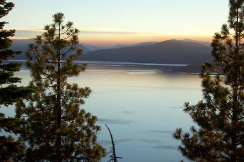
Once you reach the facility that straddles the California/Nevada border is definitely the best high-elevation vantage point (7,017 feet) on Lake Tahoe’s north shore.
Once you reach the top, you will enjoy spectacular vistas of Crystal Bay and Brockway beaches, along with the entire Tahoe basin and its watershed.
It’s a fairly easy hike to the top. A short fifteen minute hike from the fire road will lead you to the historic Stateline Point Lookout.
There are a a variety of interpretive signs along a self-guided interpretive trail, that explain some interesting history about Lake Tahoe and the local region. One story details how California stole the Brockway Hotsprings down below from Nevada in a shady “resurvey” land grab.
Another interesting fact is that up to the early 1900’s, scenic Lake Tahoe was once called “Bigler Lake”.
If you’d just like to relax and enjoy a quiet picnic, there are several strategically placed picnic tables amongst the area.
Directions:
To get there , take SR 28 (Tahoe Blvd.) from Incline toward California on the north shore. Just before you reach the California border in Crystal Bay, there’s a road off to the right named Beowawie Road. Take this road to Tuscarora Road, then right on Lake View.
Park near the gate on the fire road but of course don’t block the gate.